Map of Mountains and Seas: A Visual Taxonomy
October–November 2022poster / information_design / assignment
A visual taxonomy that maps out tales from ancient Chinese text Classic of Mountains and Seas.
Client: Graphic Design BFA, Frostic School of Art, WMU
Medium: printed posters on singleweight matte paper
Dimensions:24”x36”
Client: Graphic Design BFA, Frostic School of Art, WMU
Medium: printed posters on singleweight matte paper
Dimensions:24”x36”


Map of Mountians and Seas is also an attempt to subvert the sterotypical view on traditional literature.

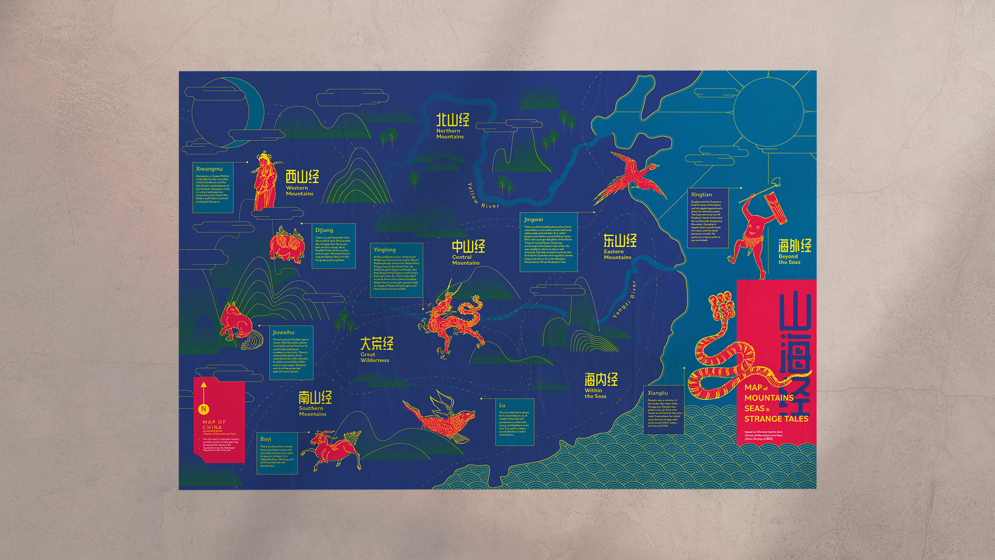
Visual Taxonomy is a classification and categlorization approach to display visual information. In Map of Mountains, Seas & Strange Tales, I used the taxonomic model to visually inform the audience about the Chinese mythic text Classic of Mountains and Seas (Shan Hai Jing 山海经). Classic of Mountains and Seas is a collection of mythological accounts of geography, medicine, beastiary, and folk lores.
I began this project by conducting the research on the text. After reading the Classic and examining exsiting materials that deconstruct its content, the decision was made to build the information on the framework of a map. The Classic is broken down by geological chapters with subsequent entries of creatures and lore. I organized the qualitative information (entries of beastiary lore) by plotting them on the map of China in their distinct regions as described by the text.
The map is also an attempt to subvert the sterotypical view on traditional literature To achieve this goal, I experimented with a bold color scheme to contrast the otherwise antique content of an ancient text. For this map, I also used clean lines and gradient for the stylistic direction, which collaborated organically with Hu Wenhuan’s original illustrations.![]()
I began this project by conducting the research on the text. After reading the Classic and examining exsiting materials that deconstruct its content, the decision was made to build the information on the framework of a map. The Classic is broken down by geological chapters with subsequent entries of creatures and lore. I organized the qualitative information (entries of beastiary lore) by plotting them on the map of China in their distinct regions as described by the text.
The map is also an attempt to subvert the sterotypical view on traditional literature To achieve this goal, I experimented with a bold color scheme to contrast the otherwise antique content of an ancient text. For this map, I also used clean lines and gradient for the stylistic direction, which collaborated organically with Hu Wenhuan’s original illustrations.
- Illustrations by Ming Dynasty artist Hu Wenhuan, who rendered many figures from Classic of Mountains and Seas. These illustrations have since entered public domain, and are free to use from Wikipedia Commons.

